Today, importance of Geographic Information System (GIS) and Remote Sensing (RS) technologies in society are improving day by day. GIS and RS technologies are being looked as an important tool for key spheres and directions of Uzbekistan: water and land resources management, agriculture, cartography, geology, ecology and others.
Numerous of young researchers and doctoral students of Uzbekistan have been thinking about applying of GIS and RS technologies in their research topics and field of studies. For implementation of those, mainly advanced knowledge of using software devices and computer technologies as well as theoretical and practical knowledge in the field of study are vital.
In this case, support of highly ranked foreign Higher Educational Institutions and qualification of their well-qualified teachers play crucial role. Erasmus+ “DSinGIS –Doctoral study in Geoinformatics” project has been giving good opportunity for doctoral students and young researchers of Uzbekistan in case of organizing 2 months scientific and practical training courses to improve their knowledge and skills in Geoinformatics.
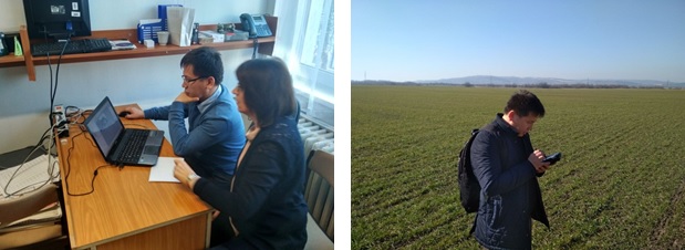
So far, several researchers and doctoral students from partner HEIs of Uzbekistan have been improved their skills and qualification in their research topic and field of studies at European partner universities. Among them, first year PhD student of the Tashkent Institute of Irrigation and Agricultural Mechanization Engineers, Mr.Zokhid Mamatkulov also has visited for two months (January 15-March 15) as a researcher to Alba Regia Technical Faculty of Obuda University, Szekesfehervar, Hungary under supervision of Dr.Wojtaszek Malgorzata on the topic of “Applying GIS and RS technologies in precision agriculture”. During the training, Mr.Zokhid Mamatkulov has strengthened his scientific and practical knowledge on Remote Sensing by evaluating quality of the satellite images, classifying types of Agricultural crops through segments, monitoring of Land cover changes by using supervised and unsupervised methods. Laboratory and field works results compared and created land use and cover maps.
Moreover, some new software for implementing remote sensing tasks as IDRISI Selva and eCognition Developer software’s opportunities have been learned.
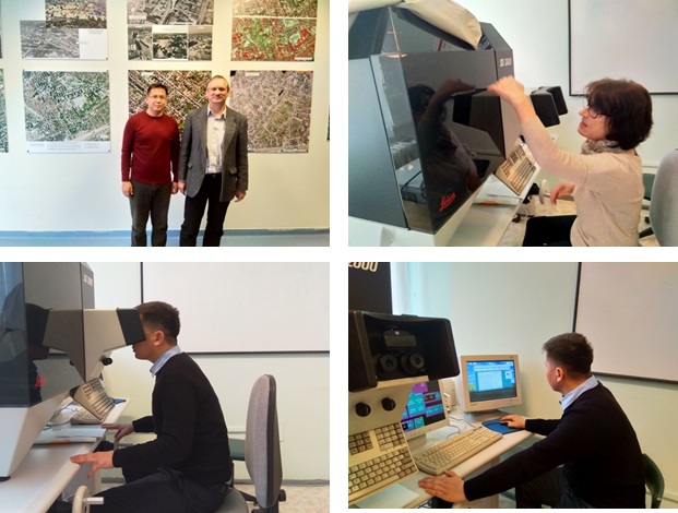
Furthermore, Mr.Mamatkulov has worked on practical and laboratorial assignments under supervision of staff of the Remote Sensing and Photogrammetry department – Balázsik Valéria and Dr.Jancsó Tamás. During the laboratory tasks, he learned how to create orthophotoplans from airborne imagery, mosaicking of aerial photography’s, projecting and setting control points by analytic methods, creating 3D models by stereo effects and their scientific theories.
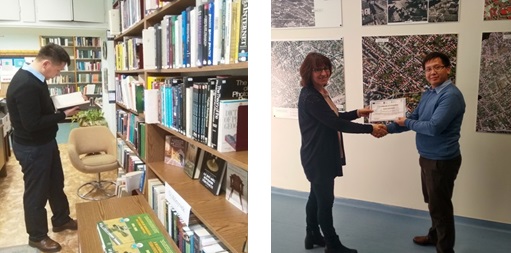
During two months period, Mr.Mamatkulov read many sphere based literatures and analysed lots of article sources related to his dissertation topic at Information Resource Centre of Alba Regia Technical Faculty of Obuda University.
“I had achieved very important and crucial knowledge on my research topic during two months’ period and I greatly appreciate DSinGIS project for giving that chance to me” said Mr.Zokhid Mamatkulov at the end of the interview.